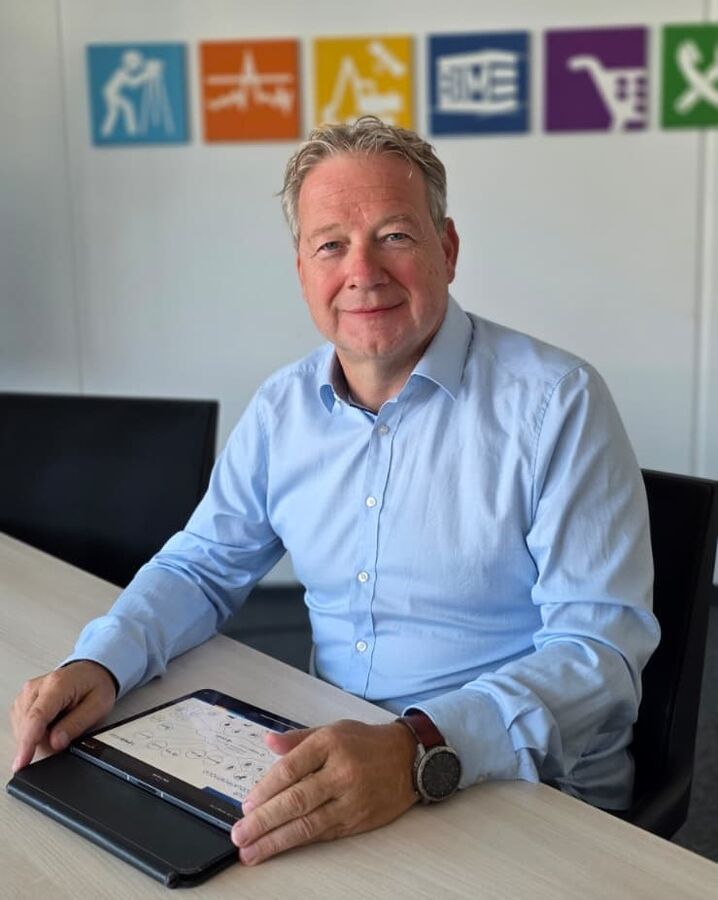
 Markus Brun, one of the three founders and managing directors of the MEB Group
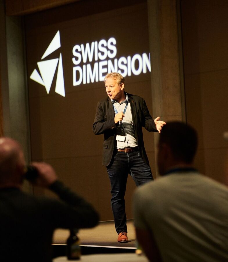 Markus Brun will speak at "Swiss Dimensions," an event organized by the MEB Group for the construction industry, on the Sursee campus.
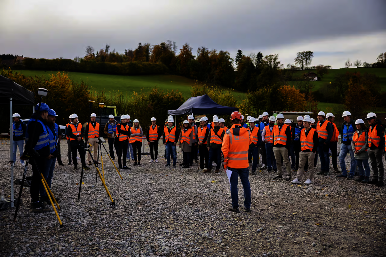 Participants can experience the digital transformation of the surveying and construction industries firsthand at the MEB Group’s in-house event.
GeoNews in conversation with Markus Brun, Managing Director of the MEB Group (Switzerland)
Markus Brun is one of the founders and remains a co-owner of the MEB Group, one of the leading Trimble partners in German-speaking countries. For over 30 years, he has witnessed the transformation of the surveying industry, from the company’s founding in the 1990s to its current collaboration with the rmDATA Group. In this interview, he discusses the history of the MEB Group, the partnership with Trimble, current trends in surveying, and why personal contact with his customers remains his top priority to this day.
GeoNews: Mr. Brun, tell us the story of the MEB Group—how did it all begin?
Markus Brun: The name MEB stands for Müller, Eigensatz, Brun—we are three surveying experts who met over 30 years ago. We worked as surveyors ourselves on a daily basis, and our motivation then—and now—is to optimize processes both on-site and in the office through seamless workflows, increased efficiency, and the prevention of errors.
We know what it’s like when something goes wrong on a construction site—that’s why we first make sure the client can continue working, and only then do we address administrative issues. We don’t see ourselves as a supplier, but as a long-term partner to our clients.
GeoNews: If you had to sum up your vision for the MEB Group in one sentence?
Markus Brun: We help the surveying and construction industries adopt digital methods to work in a more resource-efficient way. If digital planning means that a construction site no longer generates 10 percent material waste but only delivers what’s actually needed, or if machine control allows an excavator to finish 30 percent faster, then we’re not only saving costs but also conserving resources. The construction industry is one of the biggest drivers of CO2 emissions—and we see our role as addressing this issue head-on with our solutions.
GeoNews: You now cover the entire DACH region. How is Austria integrated into your organizational structure?
Markus Brun: We became a Trimble partner in Switzerland in 1996, so we’ve been with them for about 30 years. In 2024, Trimble placed its trust in us to also take on responsibility for surveying sales in Germany and Austria. At that time, AllTerra Austria was organizationally attached to Germany. We changed that after the takeover and reestablished AllTerra Austria as an equal sister company to AllTerra in Germany. The same applies to our other organizations in Switzerland—such as Allnav, BuildingPoint, and SITECH. Each operates independently and develops its own strategy.
GeoNews: What trends do you currently see in surveying technology?
Markus Brun: A major topic in the hardware sector is sensor fusion. At INTERGEO 2026, a new prism pole was unveiled that already has GNSS integrated—in other words, a prism rover. Thanks to IMU technology and AI-based filtering, the pole can even be held at an angle. A built-in rangefinder automatically determines the pole’s height with millimeter precision and records it in the field software.
The second major area is software—especially the seamless workflow from the sensor to the final result in the office. That was precisely one of the reasons I sought out a conversation with rmDATA: rmDATA is the market leader in surveying software, and we owed it to our customers to offer them the best possible data workflow experience.
The third area is cloud computing with cloud-based analysis—some of which is AI-supported—but above all, the provision of data to customers via the cloud, thereby simplifying data exchange with planners; think “data hub.”
GeoNews: Are there any developments that have personally surprised you or that you find particularly exciting?
Markus Brun: I think all of us were impressed when the large language models hit the market—the possibilities are enormous, and many of us are still in the early stages, whether it’s with Vibe Coding or MCP interfaces. For us as a Trimble partner, it’s important to stay closely involved with this topic. I’ve even started giving presentations on construction and AI myself, such as at a major Swiss construction conference. The key question is always how to use AI in a way that’s truly profitable and boosts efficiency—not just how to apply it. In addition to surveying technology, the MEB Group also sells planning software for civil engineers, as well as for building, infrastructure, and rail projects. That is precisely where our strength lies: We understand both the interface from the planner to the construction site and the reverse process—this sets us apart from competitors who are familiar with either only the planning side or only the surveying side.
GeoNews: As a surveyor, do you view developments in AI with concern?
Markus Brun: No. I don’t think the role of the surveyor on the construction site will change fundamentally anytime soon. Even with robots, we still need people to take measurements and perform inspections out in the field. One area where technology can help is occupational safety—ensuring that surveyors working in tunnels, on roads, or in railway areas are safer, for example through mobile mapping, so they no longer have to stand directly in the roadway. The real change is taking place in the office. And what I’ve observed throughout my career in digital planning, construction, and operations is this: no other profession can handle spatial data as well as surveyors—including planning data, such as in the BIM environment. That’s why, in my view, there can never be enough trained surveyors.
GeoNews: In your view, what needs to change in the industry to ensure it remains sustainable for the future?
Markus Brun: I’d say it’s about the desire for innovation, change, and further development. Often, there’s simply a lack of motivation to change processes because it requires investing time and training colleagues without immediate rewards. That’s exactly where I see our role: If digitization becomes more cumbersome instead of easier, we haven’t done it right. And the same applies to AI—if you use it as a tool that’s truly useful and saves time, that’s exactly right.
GeoNews: How did the partnership with rmDATA come about, and what’s the idea behind it?
Markus Brun: Right from our very first conversation, the proverbial spark flew—both for me and, I imagine, for Jürgen [Note: Jürgen Beiglböck, CEO of the rmDATA Group]. We wanted to build something together that would noticeably make our customers’ work easier: Anyone working in both the Trimble ecosystem and the rmDATA ecosystem should feel that these two companies have joined forces to make everything as seamless as possible. That is our shared goal.
This collaboration is particularly evident in the interplay between the field and the office—ultimately, it always comes down to the same core issue: the end-to-end workflow. These initiatives are our active contribution to countering the growing shortage of skilled workers in the industry.
GeoNews: What does this mean for data exchange in practice?
Markus Brun: Trimble Connect is already the de facto standard in Switzerland and, as a central cloud platform, connects all Trimble software and hardware. At the heart of it is seamless integration with rmDATA Geomatics: Projects are transferred directly to the device without a memory stick, and field data flows just as directly back into the geomatics solution. In the future, data from laser scanners will also be able to be processed directly in rmDATA Reality3D, where models can be created and republished—making them immediately available to the customer.
GeoNews: You provide sensors free of charge to educational institutions—what’s the reasoning behind this?
Markus Brun: At the Sursee campus, one of our employees works as an external lecturer on a roughly 70 percent workload—the campus deliberately relies on instructors with real-world experience. In addition, we support the University of Applied Sciences and Arts Northwestern Switzerland (FHNW), where Switzerland’s geomatics engineers are trained, with a Trimble Technology Lab: We provide hardware and software so that students can always work with the latest equipment, and we also give occasional lectures there. This helps keep the program attractive to aspiring professionals. The better-trained professionals are, the more readily they recognize the benefits of more efficient workflows, processes, and investments.
GeoNews: If you were to look to the future: Where will the MEB Group be in five years?
Markus Brun: We want to gradually expand what we’ve built in Switzerland to Germany and Austria as well. This is also a challenge internally: Even during the recruitment process, we make sure to attract people who believe in Success Management, because when we sit on the board of directors three months after a product launch, the first question is never how much revenue we’ve generated, but rather: Are the customers satisfied?
GeoNews: Finally, looking back, what has been the most important lesson on your journey so far?
Markus Brun: For me personally, it was the willingness to keep learning new things—whether it was building an organization with just two employees or leading seven companies. That means constantly questioning existing patterns and rules: What worked well in the past may no longer work today.
The second important insight: If you’re truly interested in a new subject area, immerse yourself in it, and talk to many people about it, you’ll quickly acquire the knowledge—without needing extensive training. It’s important to be open-minded, but also critical: There are many technologies we’ve looked into and deliberately chosen not to bring to market because we were convinced they wouldn’t make our customers happier.
Thank you very much for the interview!
Read more interesting articles about users and rmDATA products in the latest issue of the company magazine GeoNews.