Success stories
Successful clients and interesting projects
Successful together - mastering challenges
Find out how companies are setting new standards with our platforms and technologies. From precise surveying, building modeling and digital infrastructure management to efficient project management: our solutions help customers from the fields of geomatics, information systems, reality capturing and project management to successfully achieve their goals.
Discover our success stories now and be inspired!
Backing the right horse
How the surveying firm GeoTech is replacing traditional surveying with rmDATA Reality3D and conquering new business areas.
Customer-oriented services
The Winterthur Geomatics and Surveying Office demonstrates a clear service ethos with expert advice and flexible offerings.
All project data in one place
rmDATA Projects is a popular organizational solution for surveying and engineering firms in Bavaria.
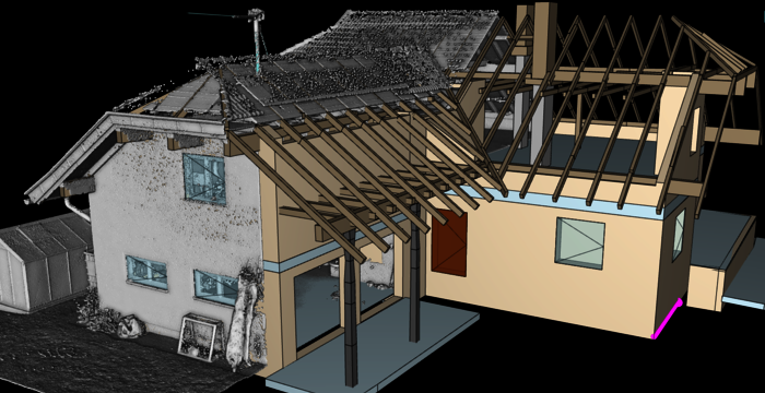
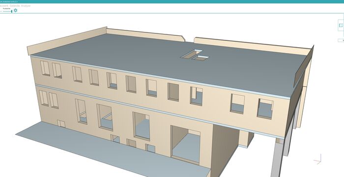
Digital precision for urban redevelopment
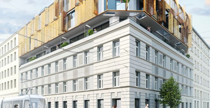
How baukult ZT GmbH successfully works with rmDATA 3DWorx and transforms 3D point clouds into submission plans in no time at all.
Capture data in real time
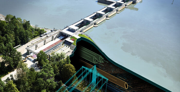
VERBUND Hydro Power relies on a comprehensive information system from mDATA that continuously provides users with up-to-date data.
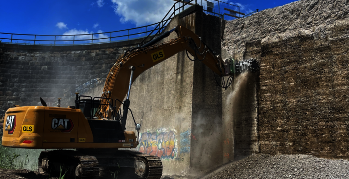
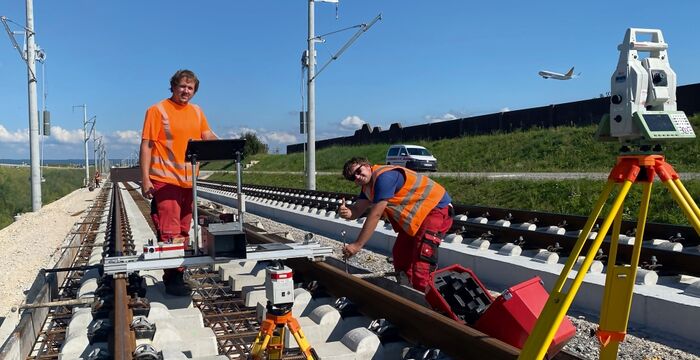
Complex construction site, high demands

Efficiency counts on the construction site—the surveying team at Implenia ensures accurate project data with software from rmDATA.
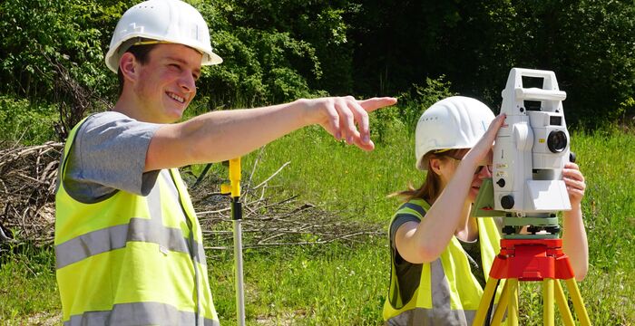
Intelligent machines and proprietary networks
Precise measurements form the basis of every construction project—today, they are supplemented by satellite-controlled machine guidance systems.
Planning principles for building renovation
Refurbishment, renovation, and conversion are booming. The basis for this is reliable existing building plans—a business model for publicly appointed surveyors.
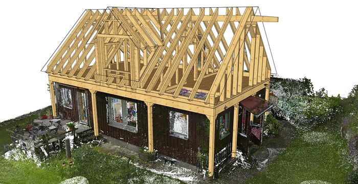
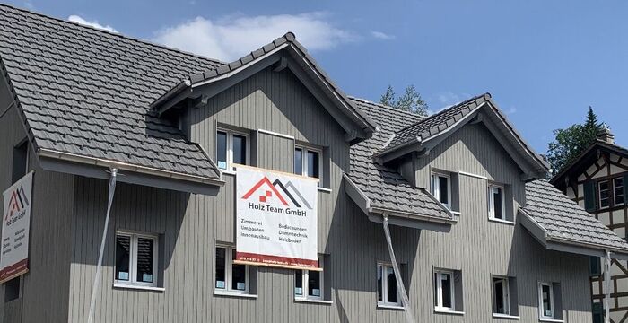
Discovering the BIM workflow for timber construction
How rmDATA 3DWorx is opening up new business areas for Holzbau Ehrlich and enabling renovation projects to be implemented faster, more accurately, and more efficiently.
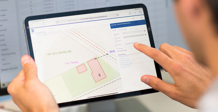
Right of way and land acquisition

rmDATA introduces a new software solution at OMV, Gas Connect Austria, and Trans Austria Gas Pipeline.
DMAV: Pilot canton of Appenzell Innerrhoden
Hersche Ingenieure is testing the rmDATA Geomatik solution in the pilot canton of Appenzell for the introduction of the new Swiss geodata model DMAV.
Digital transformation in the surveying office

With five employees and two locations, Geometris ZT KG was looking for organizational software that would simplify and optimize work processes.
Automated installation information
CableRunner is pushing ahead with the complete digitization of its processes for telecommunications networks—with a customer project from rmDATA.
Consolidation solution for the state of Tyrol
The software solution for consolidation projects is comprehensive and highlights the flexibility of rmDATA's geodetic CAD.
Hochneukirchen municipality works cost-effectively
Staking out, measuring, providing information: rmDATA Smart Infra secures long-term knowledge about infrastructure and helps to avoid unnecessary investments.
From paving to excavator control
How the construction company Karsten Oepen optimizes its projects and work processes using the geodetic CAD software rmDATA GeoMapper.
Ensuring the security of drinking water supplies

The water association chose rmDATA Smart Infra as an all-in-one solution to secure its critical infrastructure.
rmDATA 3DWorx for the Virtual Factory
Planzeichner Schweiz AG provides technical drawings and planning documents for the real estate industry as well as for architects and civil engineers.
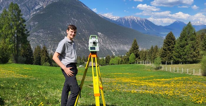
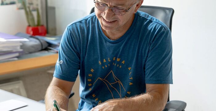
Quality must take precedence over quick profits
Surveyor Rudolf Schöffmann from Leonding in Upper Austria solves demanding surveying challenges.
Digital memory for 400 km of sewer network

The Sewer and Water Authority of the City of Salzburg benefits in its daily work from a customized solution from rmDATA Infosysteme.
From order to time recording
The organizational software from rmDATA maps the entire workflow in the project and employee management of the surveying office GEO-GEM.
Top organization in the surveying office
In order to keep track of its numerous projects, MARKOWSKI Vermessung from Feldkirch opted for the organization software.
Innovative use in timber construction
With rmDATA 3DWorx, the Ehrlich carpentry company has found an innovative solution for evaluating laser scan data in renovation projects.
intermetric is a power user of geodetic CAD
The flexible configurability of geodetic CAD using Python is a unique selling point that intermetric in Stuttgart greatly appreciates.
Maintaining a city base map with rmDATA software
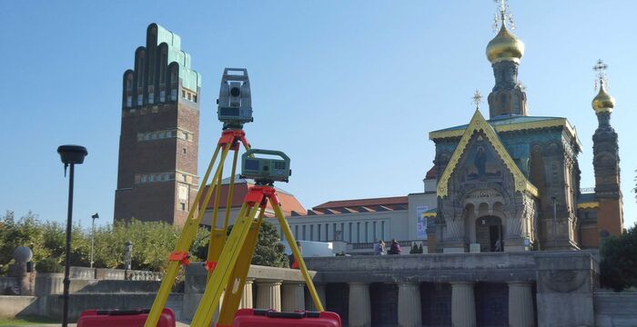
rmDATA offers the ideal solution for maintaining the extensive city base map in the science city of Darmstadt with its products.
Efficient inventory recording with 3DWorx
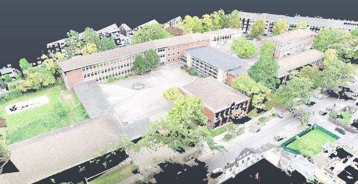
How KEMPEN KRAUSE Ingenieure combines quality and efficiency and uses modern technologies to create inventory plans.
Door opener in timber construction
Point cloud analysis is opening up new business areas in timber construction engineering for carpentry companies.
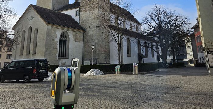
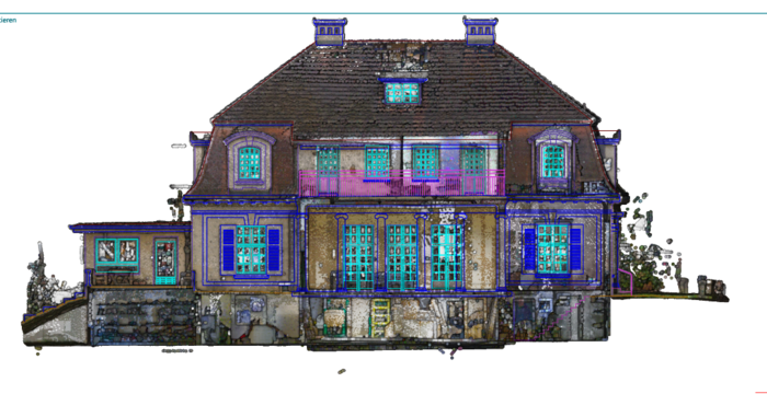
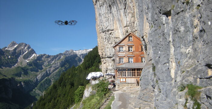
Precision in construction with modern 3D building measurement
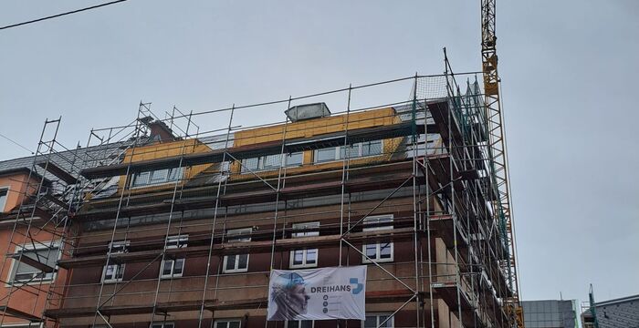
Dreihans GmbH is setting new standards in building measurement using laser scanning, because time is a major factor in measurement.
Successful networking with rmDATA Smart Networx
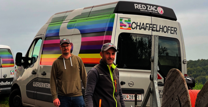
Schaffelhofer GmbH relies on rmDATA Smart Networx for planning, building, and operating its telecommunications network.
Software for the Southern Burgenland Water Association
The daily challenges faced by a water association are overcome with the help of process digitalization and a centralized software solution.
Municipal switch to comprehensive solution
How a Styrian municipality is managing its municipal infrastructure more efficiently by switching to a web-based information system.
Digital transformation in the municipality
Employees at the municipal depot in Oberwart appreciate the rmDATA Smart Infra information system with its mobile task management feature.
Sustainable knowledge for ski resorts
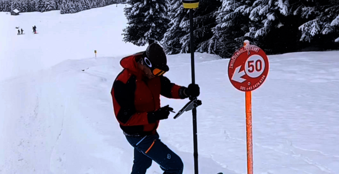
Mountain railways build and manage extensive infrastructure. To access this knowledge anytime, anywhere, a family ski resort relies on rmDATA Smart Area.
Digital efficiency in the ski resort
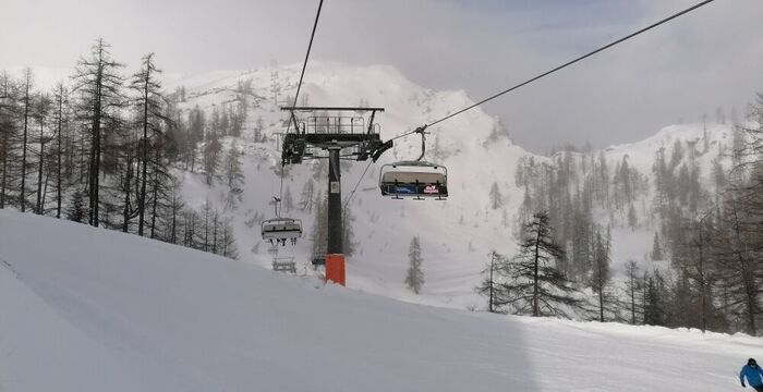
The Tauplitz mountain railways impressively demonstrate how digital innovation and practical software applications can work together perfectly.
From laser scanning to the finished room

Master carpenter Breu relies on 3D building measurement and the derivation of geometries from point clouds for his projects.
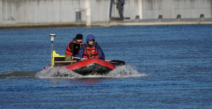
Workflow for calculating the volume of gravel pits
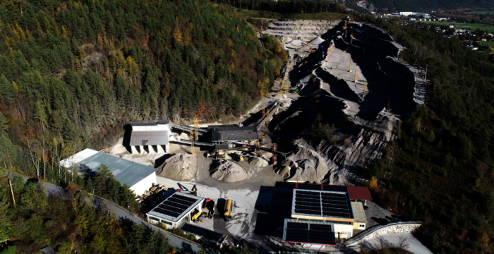
At the GeoSystem surveying office, the workflow combining ALS and rmDATA software has proven its worth in determining the volume of large gravel pits.