 The workflow of rmDATA 3DWorx and GeoMapper proves its worth when determining the cubatures of large gravel pits.
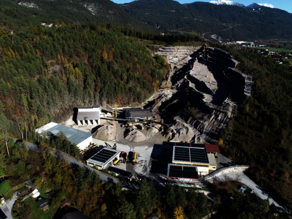
 Data from drone flights, terrestrial images and laser scans are used to evaluate this gravel extraction area.
 The surveying office GeoSystem gained its first experience with 3DWorx by scanning the interior of a building.
Came across the drone
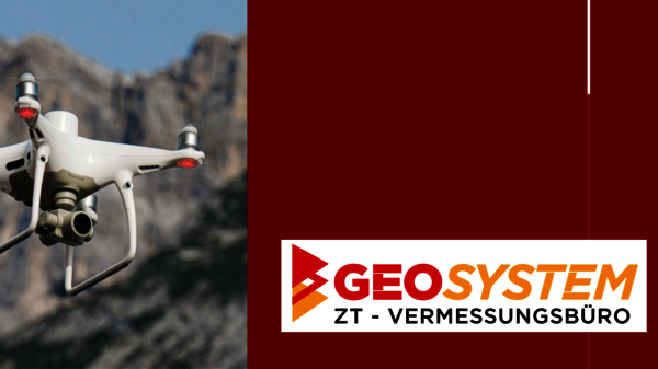
The surveying office GeoSystem from Telfs in Tyrol is increasingly relying on the workflow of rmDATA GeoMapper and 3DWorx for all types of surveying.
The core competencies of civil engineering office GeoSystem lie in the areas of cadastral and building surveying as well as in special technical projects. Peter Rittinger, Valentino Espa and Mario Pickelmann took the plunge into self-employment together in 2010 after many years of experience and have been working together successfully as a team ever since.
With the founding of the office, technical surveying with modern equipment was accelerated. Laser scanning and drone flights have opened up new areas of business. The orders start with interior documentation, continue with the determination of roof areas for PV systems or the mass determination of mining areas and extend to the delivery of point clouds to planners. For the analysis of laser scans and photogrammetry point clouds, the GeoSystem team relies on rmDATA 3DWorx. The WebShare module for 3DWorx is used to make processed point clouds available to clients via a cloud application. "Since we have the rmDATA products in-house and we really appreciate the data flow within the products, it was obvious for us to also rely on 3DWorx," explains Peter Rittinger.
Building plans with the building construction shell
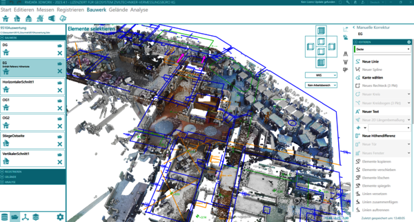
The surveying office gained its first experience with 3DWorx with the interior scan of a building, from which the required geometries were then derived. After evaluating the point cloud, the next step was to create 2.5D plans in rmDATA GeoMapper using the specialized shell for building plans.
With this configuration, users create site plans, views and sections for the as-built documentation of buildings. Using the templates provided, the relevant geometries from rmDATA 3DWorx are transferred to GeoMapper as the basis for drawing up the plans. "Meaningful plan representations with hatchings, architectural dimensions and room stamps are created in no time at all. We are very satisfied with the GeoMapper and 3DWorx package," says Peter Rittinger about the workflow. The predefined workflows in rmDATA 3DWorx support the users and are easy and intuitive to learn, as the Managing Director emphasizes.
"Thanks to rmDATA, point clouds don't cause bad weather for us!"
Peter Rittinger, GeoSystem ZT - Surveying office, Telfs
3DWorx & GeoMapper for cubatures
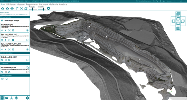
The workflow consisting of rmDATA 3DWorx and GeoMapper also proves its worth in the GeoSystem office when determining the cubatures of large gravel pits. The data from a drone flight as well as from terrestrial images and sometimes also from laser scans flow together into the 3D evaluation. The big advantage of this is that the terrain can be constructed from point clouds, e.g. using breaklines, and then blended with artificial surfaces in the DTM shell for rmDATA GeoMapper. "With the support of rmDATA's dedicated customer advisor, we have defined an optimal process for our company to determine the dimensions and can deliver the required results efficiently," confirms Peter Rittinger.
Increase your efficiency in point cloud processing – try rmDATA 3DWorx and see how quickly you can turn extensive point clouds into precise 3D models. The experts at rmDATA are available to answer your questions and provide personalized advice.
About Geosystem - Ziviltechniker Vermessungsbüro
With expertise, maximum precision and state-of-the-art technology, the GEOSYSTEM surveying office from Telfs in Tyrol lays the foundation for every successful construction project: a detailed survey. Before founding the civil engineering surveying office "Geosystem" in 2010, the team DI Peter Rittinger, Valentino Espa and Mario Pickelmann had already been working together for several years. The office's customers benefit from years of experience, reliability, precise work and individual advice. The portfolio ranges from boundary surveying and determination of property boundaries, servitude and parification plans, plans in accordance with Tyrolean building regulations, cubature calculations, parification or laser scanning. In technical surveying, the team offers e.g. special surveys in industrial construction (hall construction, machine lines, ...), road surveying (3D lines), drone surveying, sewer cadastre, pipeline and light cadastre, landfill documentation and much more.