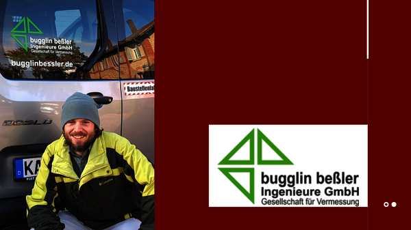
 Ben Schmidt of bugglin beßler Ingenieure GmbH
 3D model of a steel beam
How bugglin beßler Ingenieure is breaking into new business areas with 3D laser scanning and rmDATA Reality3D.
The engineering and surveying firm bugglin beßler Ingenieure GmbH, with offices in Karlsruhe and Neuburg am Rhein, offers a wide range of surveying and geodata services —from construction surveying and deformation measurements to evacuation and emergency plans. With the arrival of surveying technician Ben Schmidt, who had already gained experience in 3D laser scanning during his apprenticeship, the new data collection method gained momentum at the firm. This also created a need for powerful software for point cloud analysis. The solution was found in rmDATA Reality3D.
Traditional As-Built Surveys vs. Laser Scanning
The requirements for as-built documentation and construction surveying are becoming increasingly complex. When it comes to sophisticated infrastructure projects or historic buildings, traditional surveying methods quickly reach their limits when capturing high levels of detail and complex geometries. Subsequent field visits due to missing data cost time and money.
At the same time, the market is increasingly demanding high-precision 3D data and digital building models (BIM). For bugglin beßler Ingenieure GmbH, the question arose of how state-of-the-art surveying methods could be seamlessly integrated into everyday office work to offer customers added value and expand the company’s service portfolio.
New Employee, New Measurement Methods
With the arrival of surveying technician Ben Schmidt—who had already gained experience in 3D laser scanning during his apprenticeship—the use of laser scanning really took off. It was Schmidt, in no small part, who convinced his boss of the numerous advantages of this 3D measurement method for as-built surveys.
However, to fully harness the potential of point clouds, the team needed a suitable software solution for post-processing the 3D data. They found what they were looking for in rmDATA Reality3D, the software for efficient point cloud processing. The advantages included the fact that it operates independently of CAD software, offers extremely high performance with large data sets, and is intuitive to use and quick to learn.
Trial Version Proved Convincing
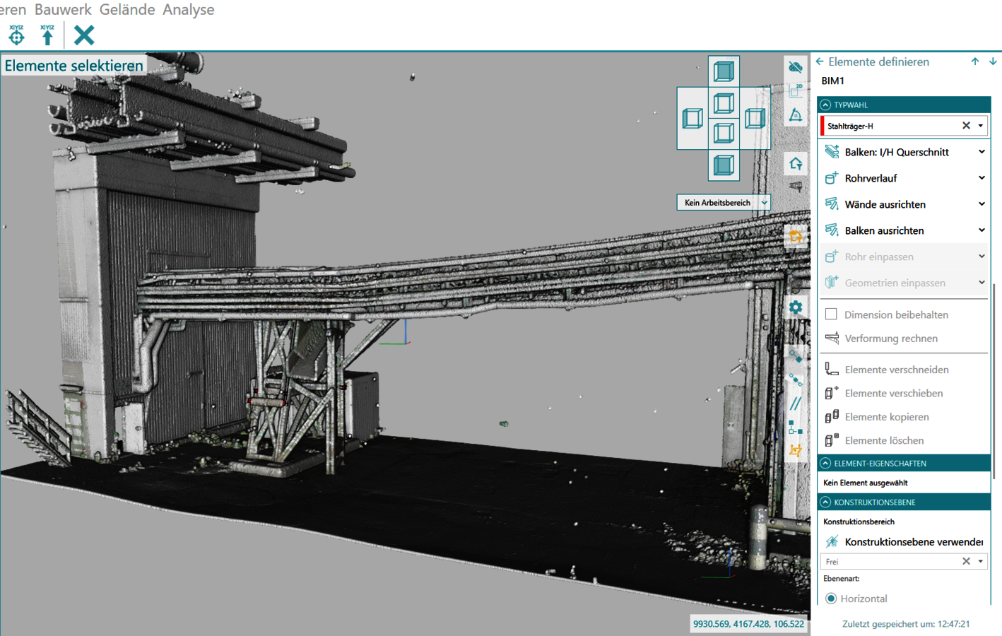
After a trial period, the decision to go with rmDATA Reality3D was made quickly. The firm realized it had chosen the right solution. Compared to conventional vendor solutions, the software stood out for its performance and user-friendliness. After just a short training session, Ben Schmidt was able to handle his first projects independently and generate floor plans and elevations directly from the point cloud in just a few intuitive steps. Later projects also incorporated BIM and 3D models.
“It’s the multitude of little details in the Reality3D program that make all the difference—such as the combination of keyboard and mouse controls or the seamless switching between 3D and 2D views.” Ben Schmidt
The surveying technician admits that the workflow didn’t immediately become faster with the introduction of the new data collection process: While on-site scanning speeds up the process, he currently still needs a little more time in the office to analyze and process the point clouds. However, that should change as early as the next project. The major advantage stems from the fact that the entire reality is fully available in the office—with data at a very high level of detail. From the raw data—the point cloud—a wide variety of deliverables can be created for the client, and the 3D model is just one of them—another major benefit.
A Flagship Project in the Paper Industry
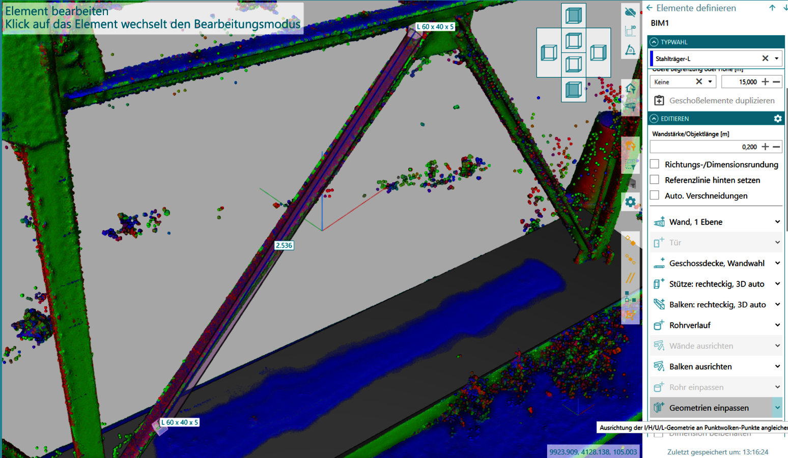
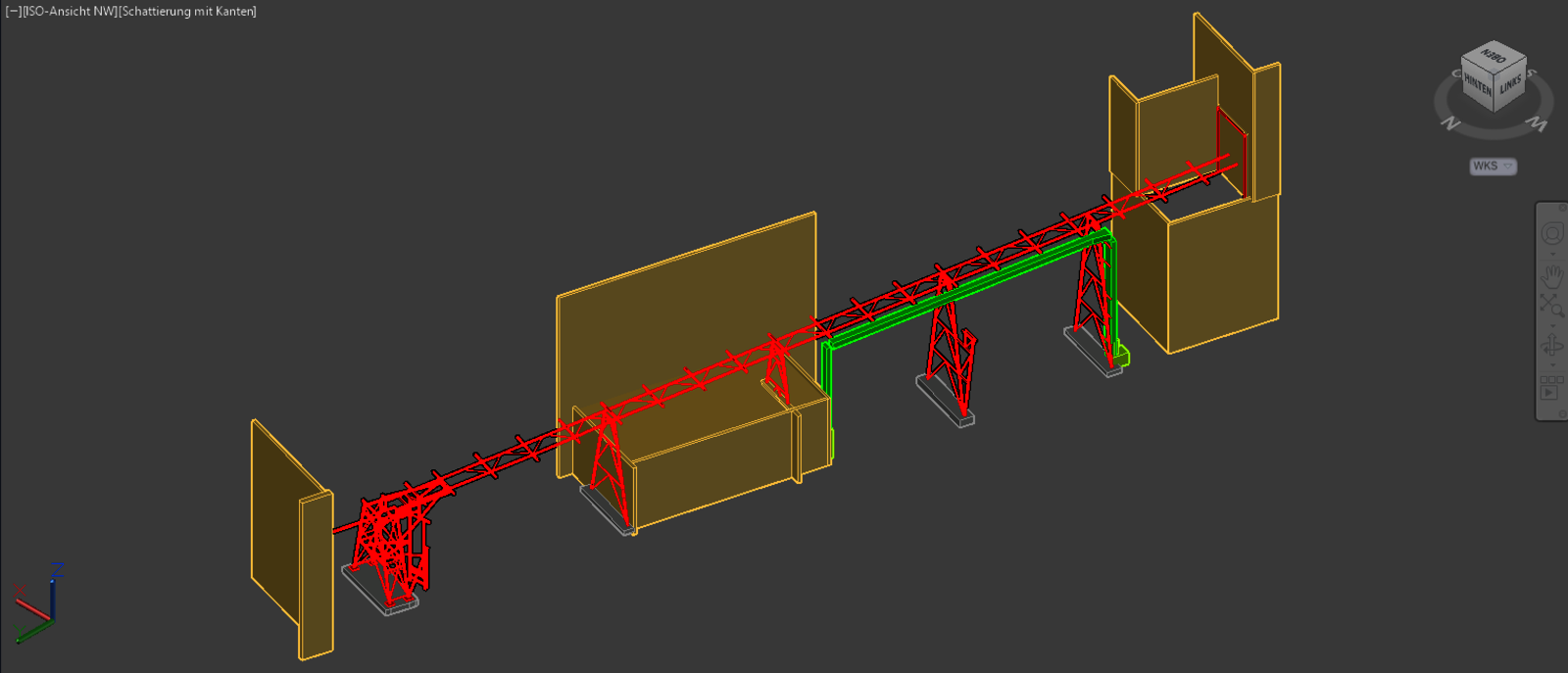
A recently completed project demonstrated just how flexible the combination of hardware and rmDATA Reality3D can be: For the expansion of a paper mill, an existing pipe bridge needed to be captured in 3D as an obstacle for subsequent trades. Benjamin Schmidt used the “Open BIM Models” module in Reality3D for the first time for this project. Features such as automatic pipe detection and the detection of beams and columns assisted him in the modeling process. The result was delivered as a DWG file, but thanks to Reality3D’s Open BIM interface, a vendor-neutral export in IFC format would also be possible at any time—for example, for downstream structural analysis programs.
Efficiency, Flexibility, and New Business Opportunities
The engineering firm reports positive results from the combination of modern laser scanning technology and the capabilities of rmDATA Reality3D. This opens up new business opportunities, as 3D as-built surveys and 3D modeling perfectly complement the portfolio of bugglin beßler Ingenieure and enable the surveying firm to attract new clientele in the fields of BIM and industrial planning.
In addition to the software, the partnership with rmDATA is also a major plus: “The support and customer service at rmDATA are personalized and much more accessible than those offered by large manufacturers. This represents a significant advantage for us in our day-to-day work!”
With rmDATA Reality3D, bugglin beßler Ingenieure GmbH has set the course for the future: highly accurate measurement data is transformed into digital datasets that open up entirely new market opportunities for the engineering firm.
“It's the many little details in the Reality3D program that make all the difference - such as the combination of keyboard and mouse controls or the seamless transition between 3D and 2D views.”
“The support and customer service at rmDATA are more personalized and much easier to reach than those offered by large manufacturers. This is a major advantage for us in our day-to-day work!”
Are you also interested in a centralized data management system for your projects?
Our experts would be happy to provide you with a no-obligation consultation.
About bugglin beßler Ingenieure GmbH
The surveying firm bugglin beßler Ingenieure GmbH, with offices in Karlsruhe and Neuburg (Pfalz), offers services in the field of surveying support for projects. The firm’s scope of work includes surveying tasks of varying scales, ranging from site staking out to construction supervision of complex building projects.
The team has many years of experience in surveying and supporting construction and infrastructure projects. Their technical expertise spans various fields of application, including power plant construction, industrial facilities, and residential and building construction projects. Based on this expertise, surveying tasks are carried out precisely, on time, and with a practical focus.