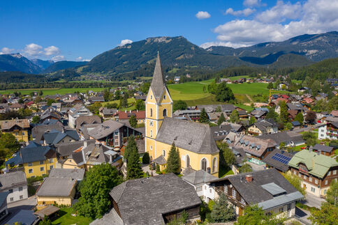
When Bad Mitterndorf switched to rmDATA Info, its original goal was simply to modernize its digital utility network database. However, the result has been much more than that: a central platform where infrastructure and municipal data are consolidated, managed, and made available to various departments.
Today, the platform not only consolidates water and sewer data. Buildings are already being managed there, and other areas such as bridges and street lighting are in the planning stages. Even the region’s approximately 180-kilometer-long cross-country ski trail network is set to be fully mapped in the system in the future.
Here’s how the municipality benefits from the new solution:
- A central platform instead of multiple separate specialized applications
- Quick and straightforward utility information for residents
- Mobile access to important infrastructure data directly in the field
- Gradual integration of additional departments and data areas
- Integration of 180 kilometers of cross-country ski trails, including future snowmaking infrastructure
“The decisive factor was that all data is available in a single program and you get a quick overview,” says Rene Ziller, Department Head for Drinking Water, Waste, and Sewer.
How Bad Mitterndorf turned a legally mandated project into a central data hub, why providing information is now significantly faster, and what role the region’s cross-country ski trails even play in this.