ÖBVI Kai Grünhagen from Lübeck has established a workflow that is completely digital from data acquisition to the finished plan - and has thus opened up a new business segment.
The Kummer surveying office specializes in surveying services for private individuals, property developers, architects, engineers and public clients. The ÖbVI relies on a continuous data flow - from recording in the field to graphic design - with a Geosoft solution and the geodetic CAD system rmDATA GeoMapper. By using rmDATA 3DWorx for point cloud evaluation, ÖbVI Kai Grünhagen recently expanded his portfolio to include precise evaluations from 3D laser scans. In a recent project, he exploited the full potential of the software combination and is delighted.
The workflow is crucial
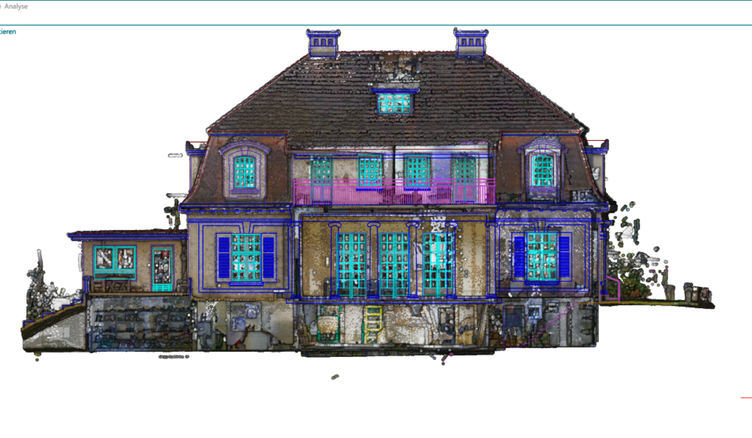
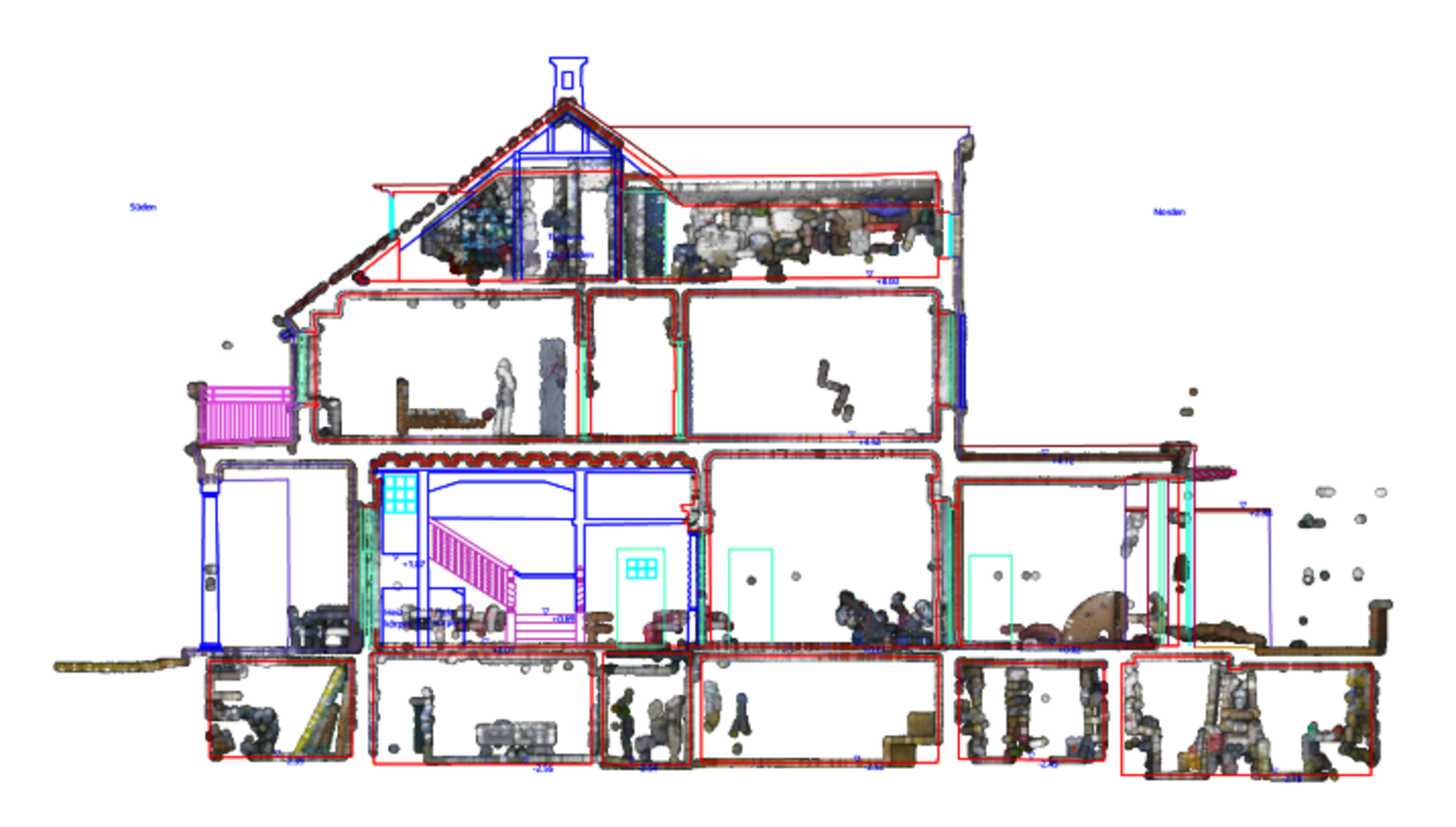
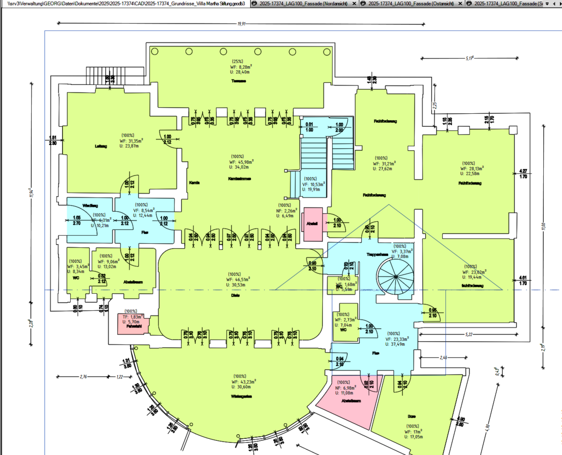
A planned extension to a listed villa lacked up-to-date and accurate floor plans, sections and elevations. Using the 3D laser scanner, the Kummer surveying office captured around 1,000 m² of living space with 325 viewpoints in just two days.
After registration and correction, the office staff derived geometries from the point clouds. The surveying engineer emphasizes that they are becoming faster and more efficient from project to project: "The learning curve in 3DWorx is very steep and it was exciting to explore all the possibilities in the software for the listed villa." Grünhagen exported the DWG files to rmDATA GeoMapper for final elaboration, dimensioning and surface calculation in accordance with DIN277.
Efficiency and time savings
Using the appropriate tools in 3DWorx, exact floor plans, building sections and façade views for the 150-year-old building could be provided in a very short time in order to visualize construction options as a reliable basis for the architect and the monument protection authority. Grünhagen emphasizes the time savings and efficiency: "What counts is the smooth workflow between the software products in order to be able to handle projects like this efficiently."